From Matsimäe’s Lake Vahessaare across Seli bog to Simisalu
We are in Kõrvemaa nature reserve between the lakes of Matsimäe.
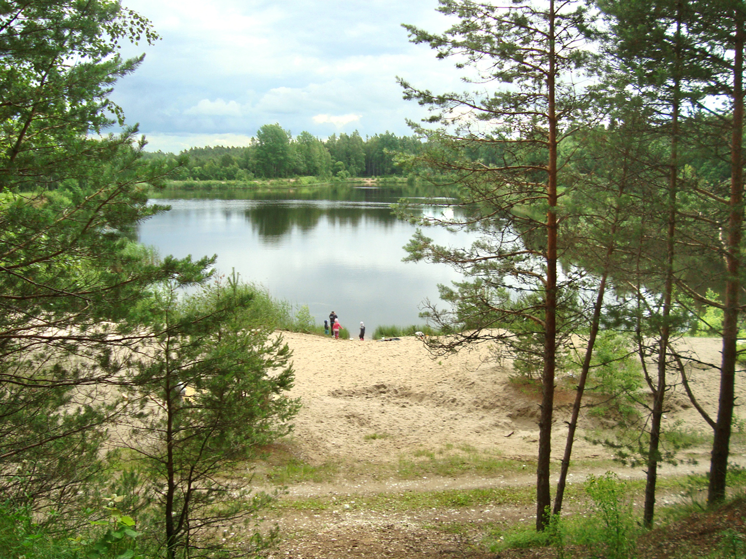
Matsimäe Lake Pühajärv is one of the deepest among Järvamaa bog lakes. The depth of this circular lake covering 5.5 ha can reach more than 8 metres.
The lake’s sandy bank has a place to swim, a jetty for boats and a campsite, together with possibilities to build a fire with provided firewood, table and benches under a roof and finally a toilet. Travellers from all over the world are grateful to the State Forest Management Centre!
From the lake Pühajärv about 1 km to the former Matsimäe sand quarry. People are welcome here as well. There is a place for a bonfire, roof covering with benches and a table, a toilet and a rubbish bin on the high northern slope of Lake Vahessaare, which emerged in the old quarry. People can also put up a tent, plus three can spend the night in the woodshed hayloft. The lake is popular with swimmers.
More information: Tel. +372 604 7212; Info.aegviidu@rmk.ee
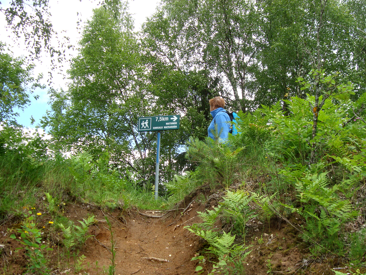
A signpost points to Matsimäe–Simisalu 7.5 km long nature trail, which leads through Seli bog to Lake Seli and on across Ohusilla Hill and Kollassaare ridge to Simisalu.
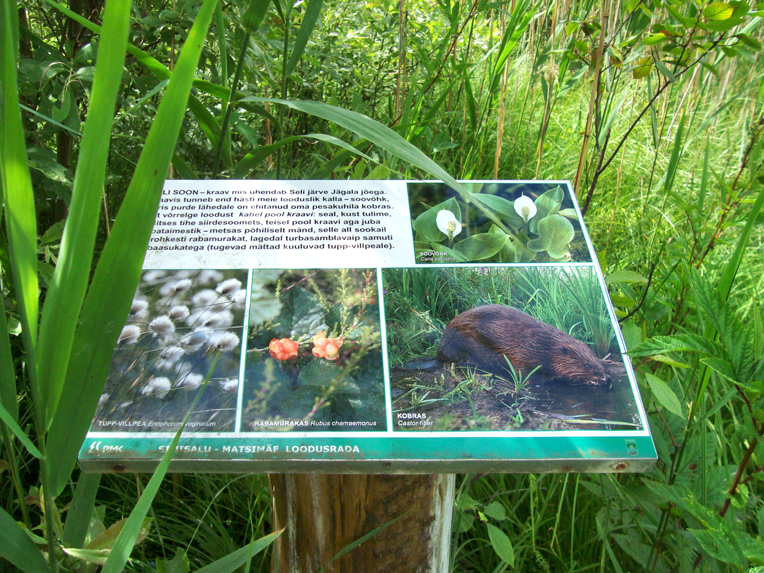
The trail was already marked in 1972, so it has offered a view of untouched bog landscape for half a century, and also traces of human habitat on bog islands and low uplands. Typical bog nature is introduced on roadside information boards.
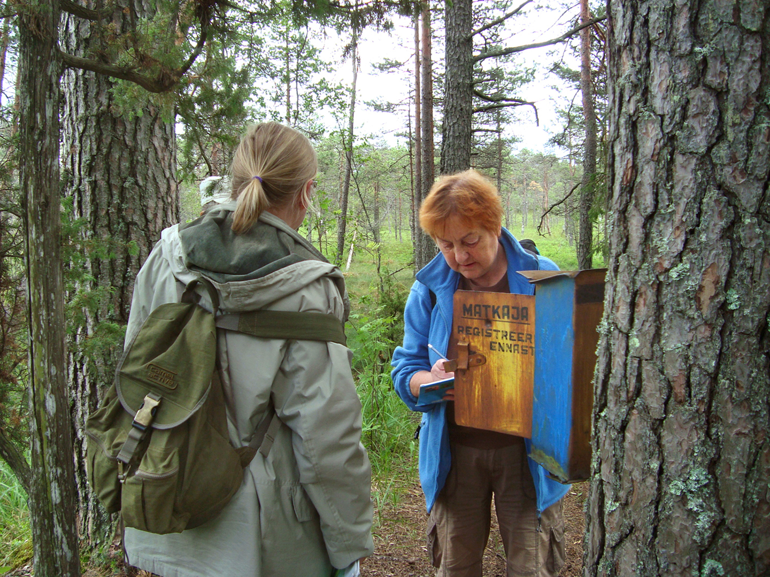
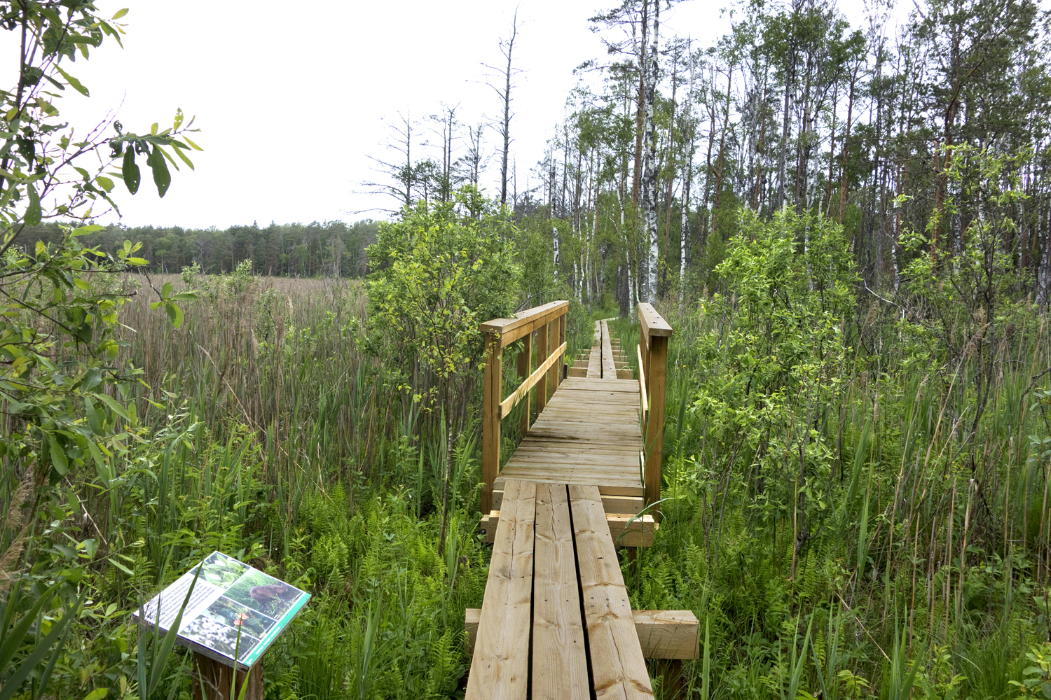
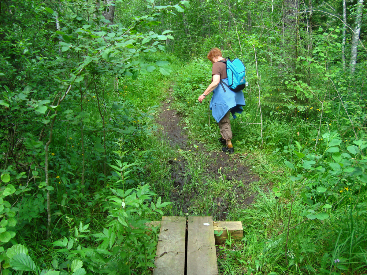
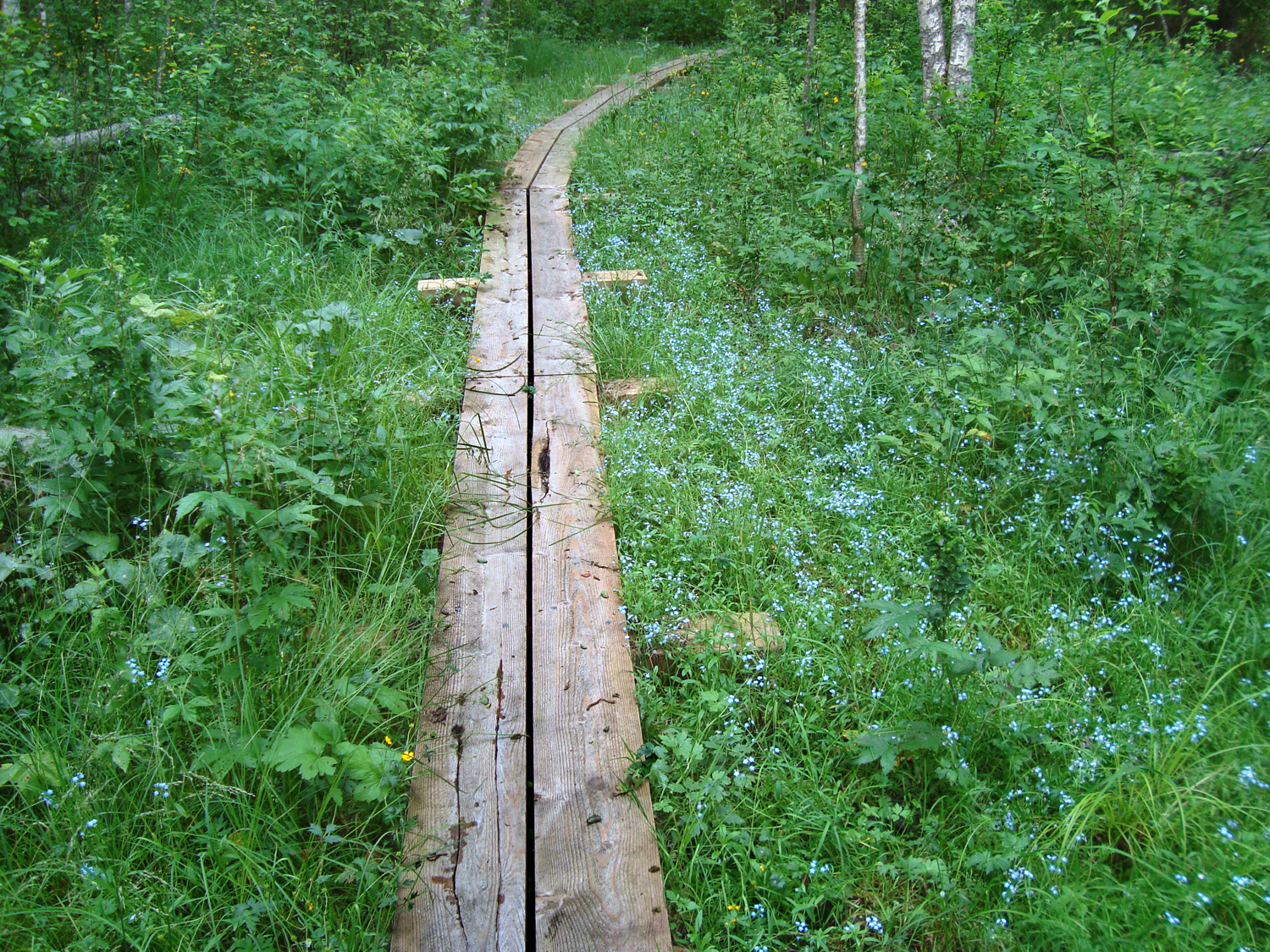
We write our names in the guestbook in the box attached to a tree and step along the fine new boardwalk into the silence of the July bog.
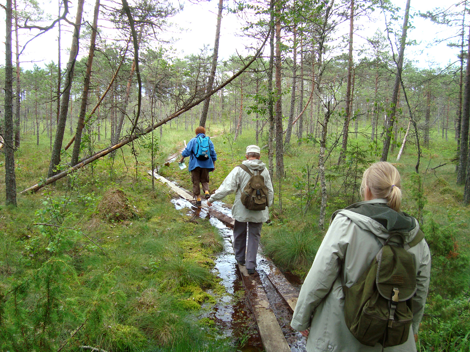
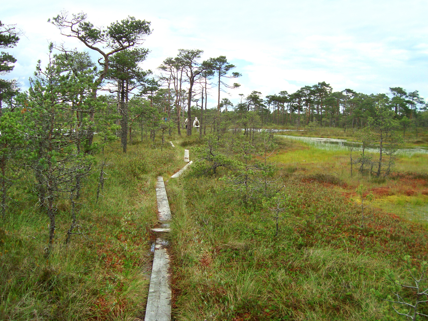
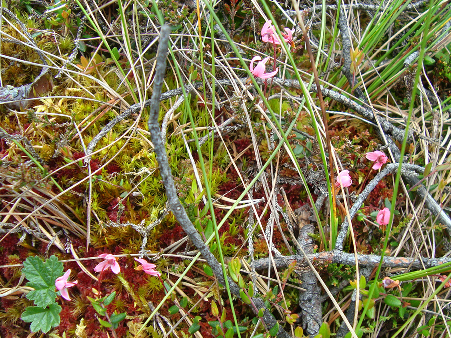
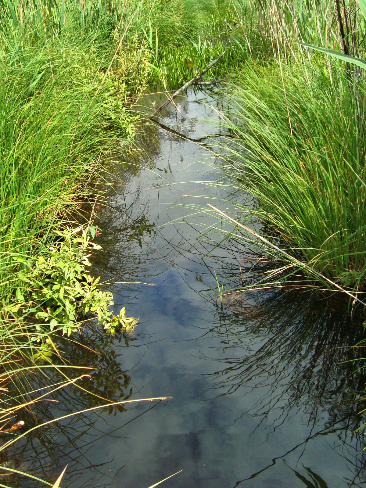
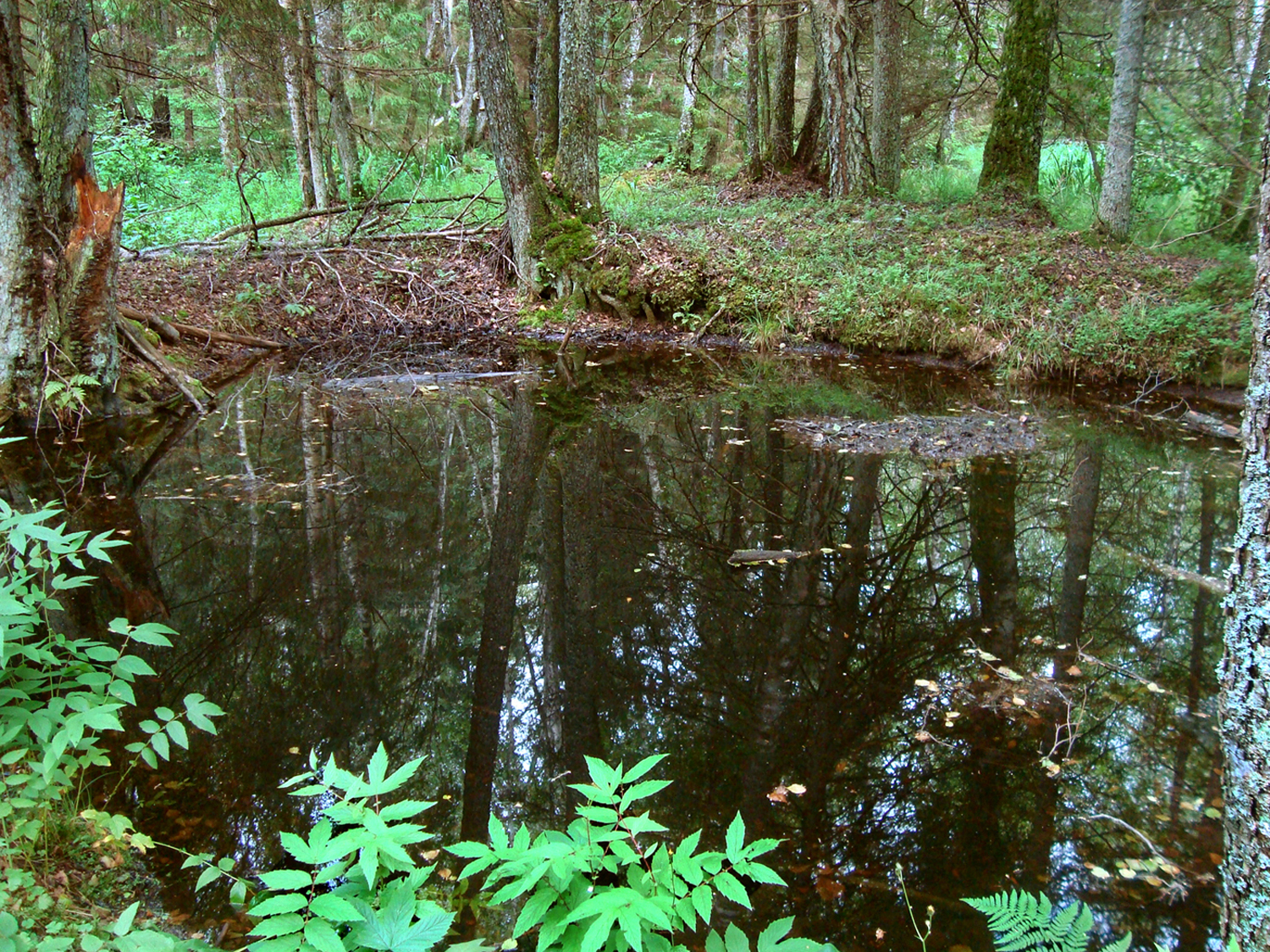
The first part of the trail runs between wet hollows and bog pools. When the bog expands, the hollows may develop into bog pools. The usually brown water pool emerged on a concave or flat ground when the flow of surface water stopped.
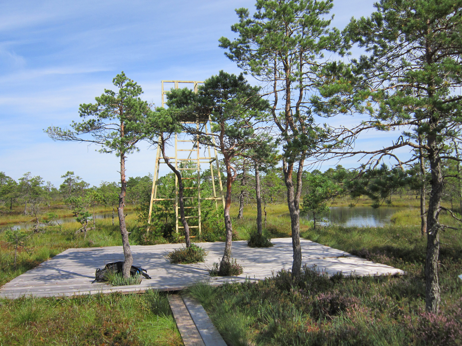
After about 500 m, we can enjoy a broader vista from the viewing tower.
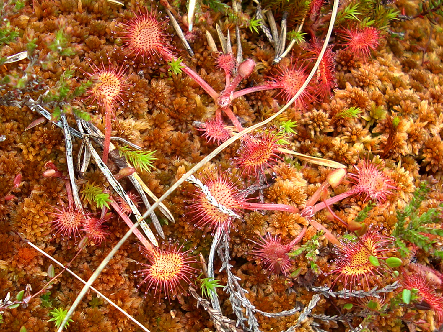
The bog landscape is said to be at its most spectacular in the autumn, although there is plenty to see in all seasons.
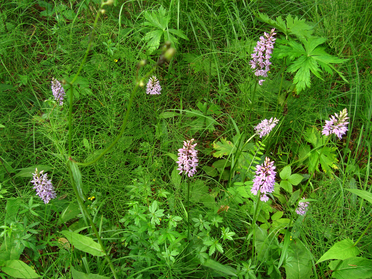
According to a legend, hare’s-tail cottongrass (Eriophorum vaginatum) flapping in the wind developed from the hair of the Estonan national hero Kalevipoeg. It can also be called tussock cottongrass, or sheathed cottonsedge. The hairs can be added to cotton and wool.
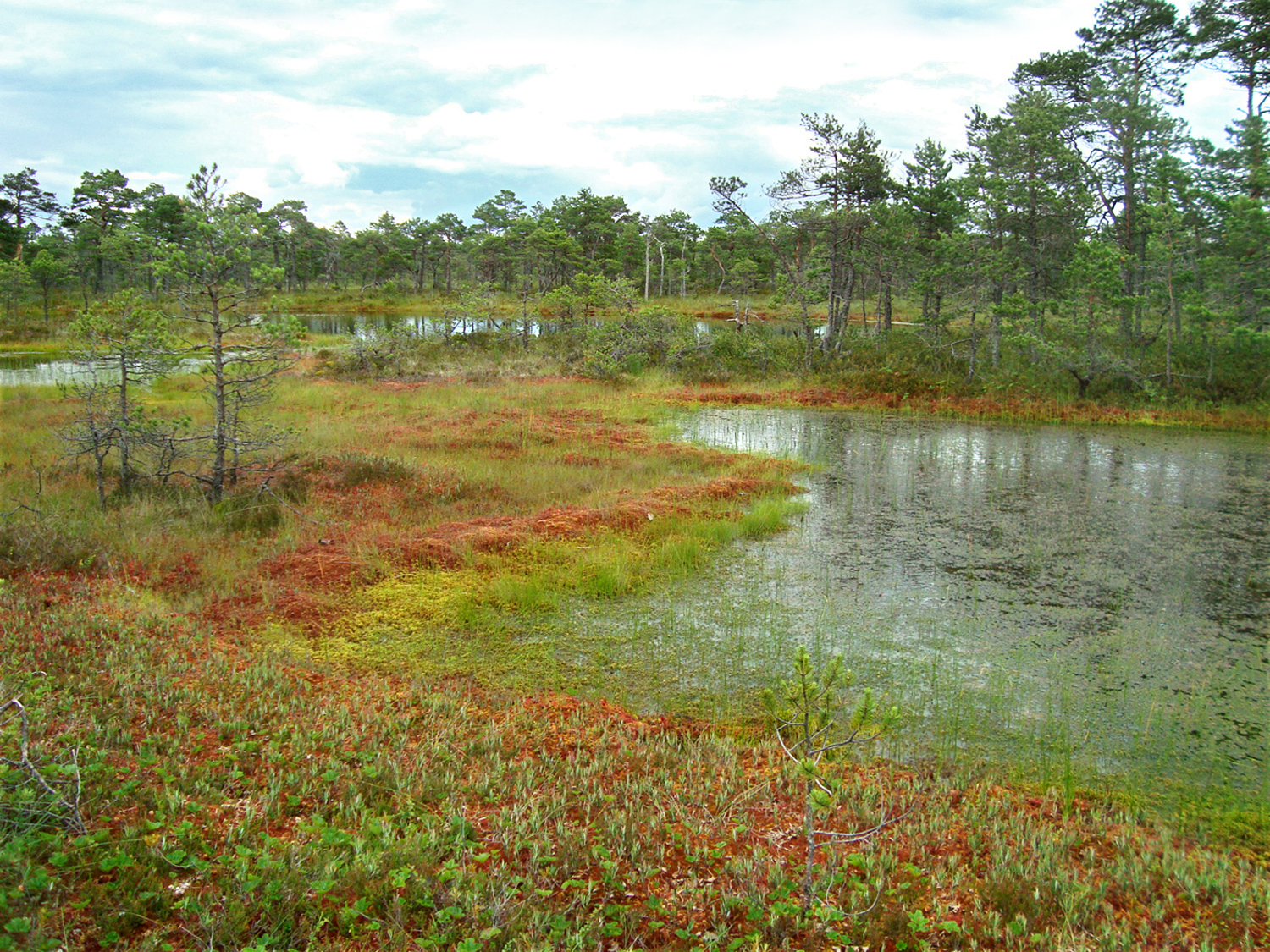
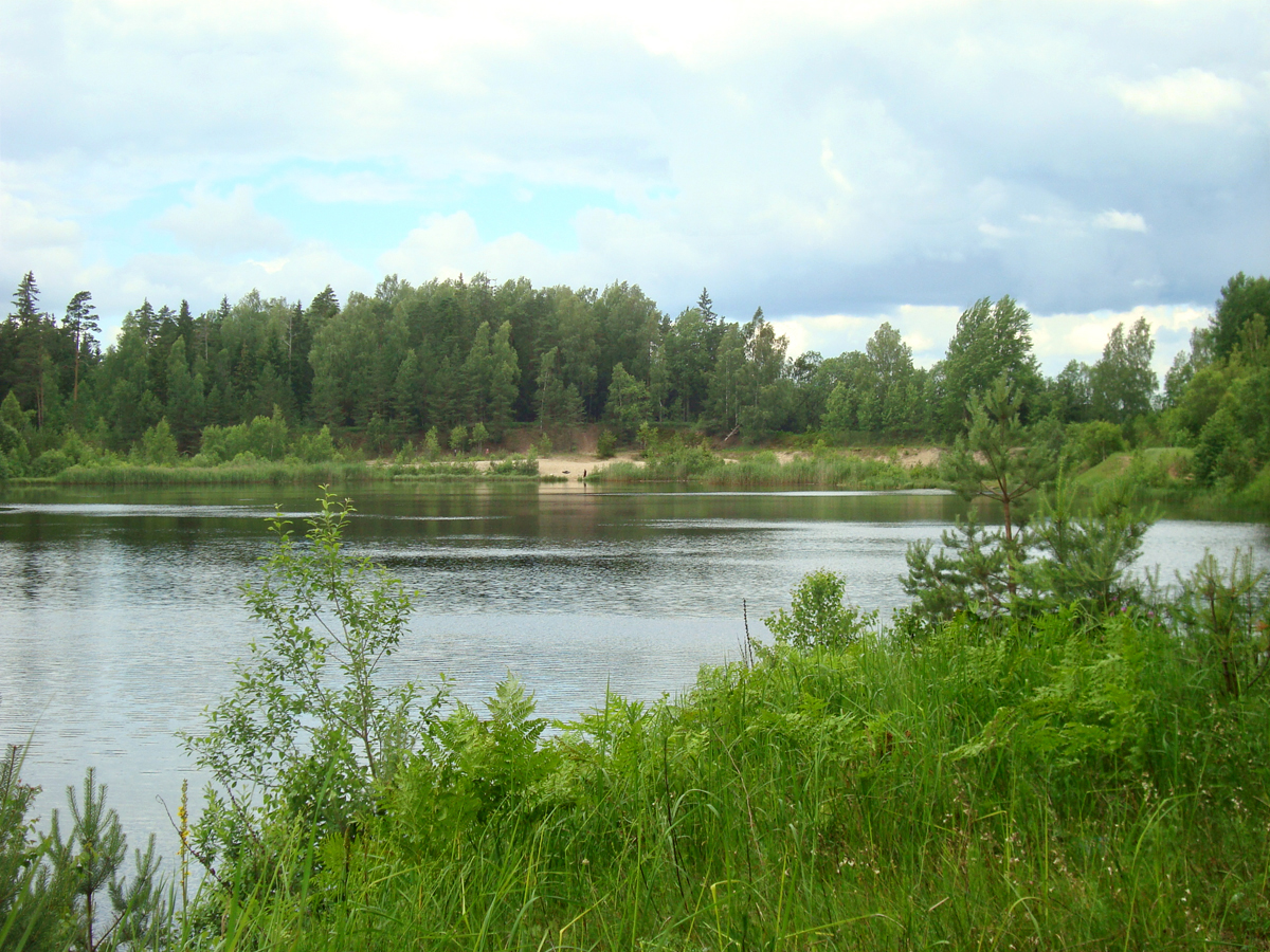
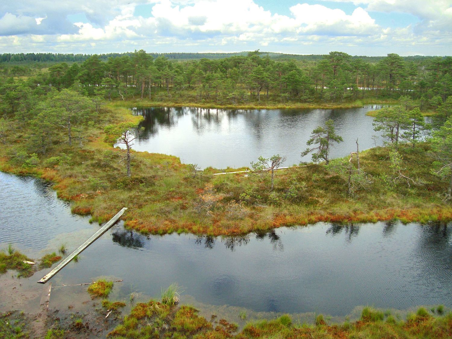
The boardwalk takes us (about 2 km from the start of the bog walk) to the swaying banks of Lake Seli. It is almost round in shape and covers the area of 17 ha; it is getting a bit overgrown. In 300 m we cross Seli ditch, which connects Lake Seli with Jäneda River. Various fish can reach the lake in spring namely along this ditch. The lake is a nesting place for numerous birds.

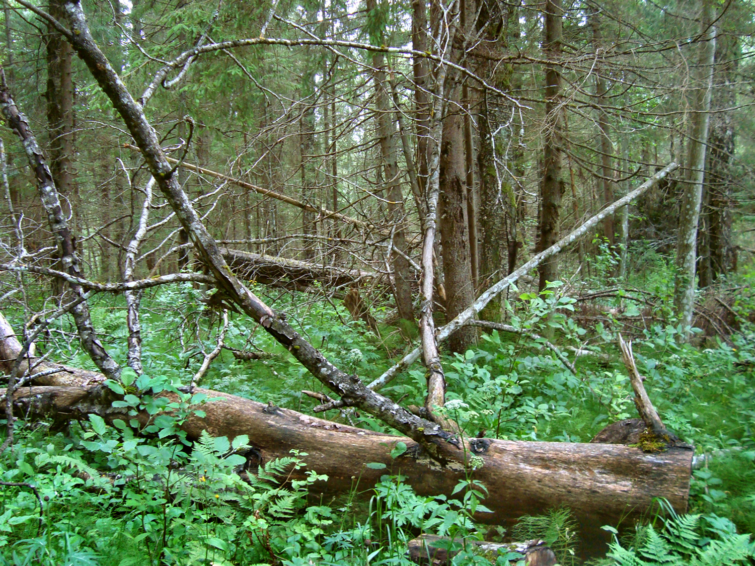
About 3.4 km of the bog walk has been done when we reach a long narrow ridge – Ohusilla Hill. Ridges were made of gravel that were accumulated by melting water flowing in ice cracks at the end of the Ice Age. The thin and calciferous soil is mostly good for pines and firs. The underwood, rich in species, is home to plants used to acidic soils (wood sorrel, lingonberry, blueberry), also plants that prefer soft humus soil. This type of forest is called hillock forest.
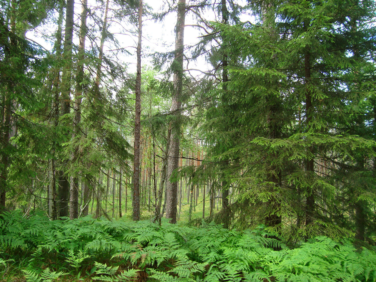

We continue in a tall fir forest and between breast-high plant stalks.
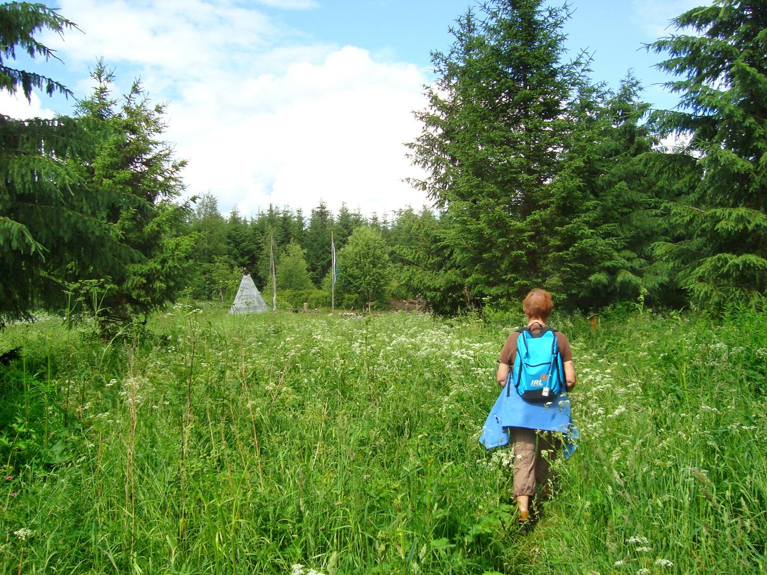
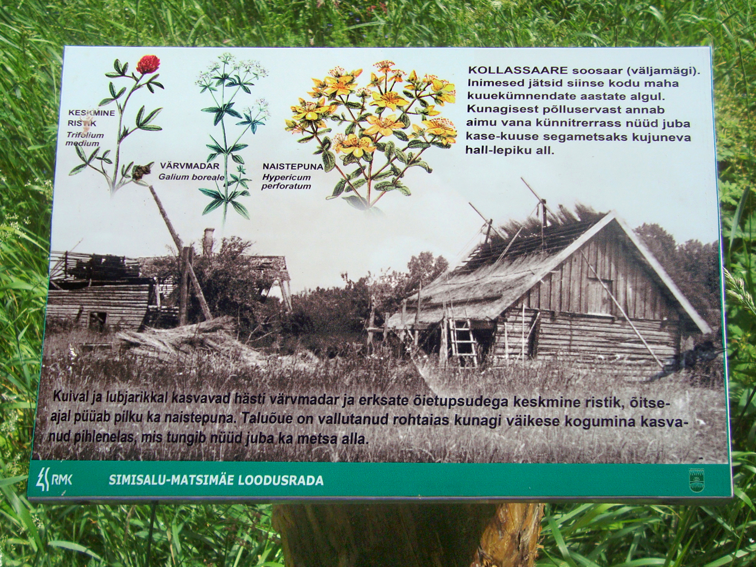
Over half the road to Simisalu has been done (ab. 4.6 km from the start of the bog walk), when we reach the old farmstead on Kollassaare bog island.
In olden days, such islands offered refuge when danger threatened. But not only – there were farms on the islands as well, people lived, worked and communicated even in such remote and hidden places.
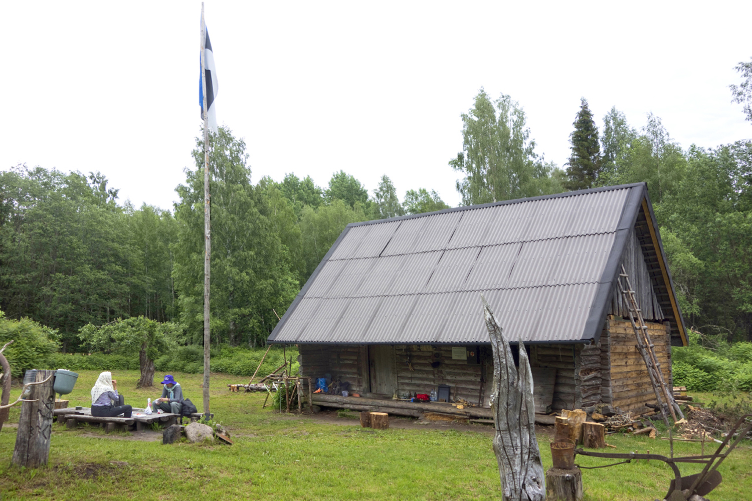
Kollassaare farm was abandoned in 1961. The farmstead is now managed and looked after by the non-profit organisation Estlander. A traveller with simple needs can spend the night here and make use of everything essential; more demanding people have at least a chance to rest a bit before setting off again.
Pilgrims who need accommodation at Kollassaare should not just turn up (the house may easily be full), but register in good time on Estlander homepage and learn about the rules at Kollassaare. MTÜ Estlander, phone: 5563 4030; info@estlander.org
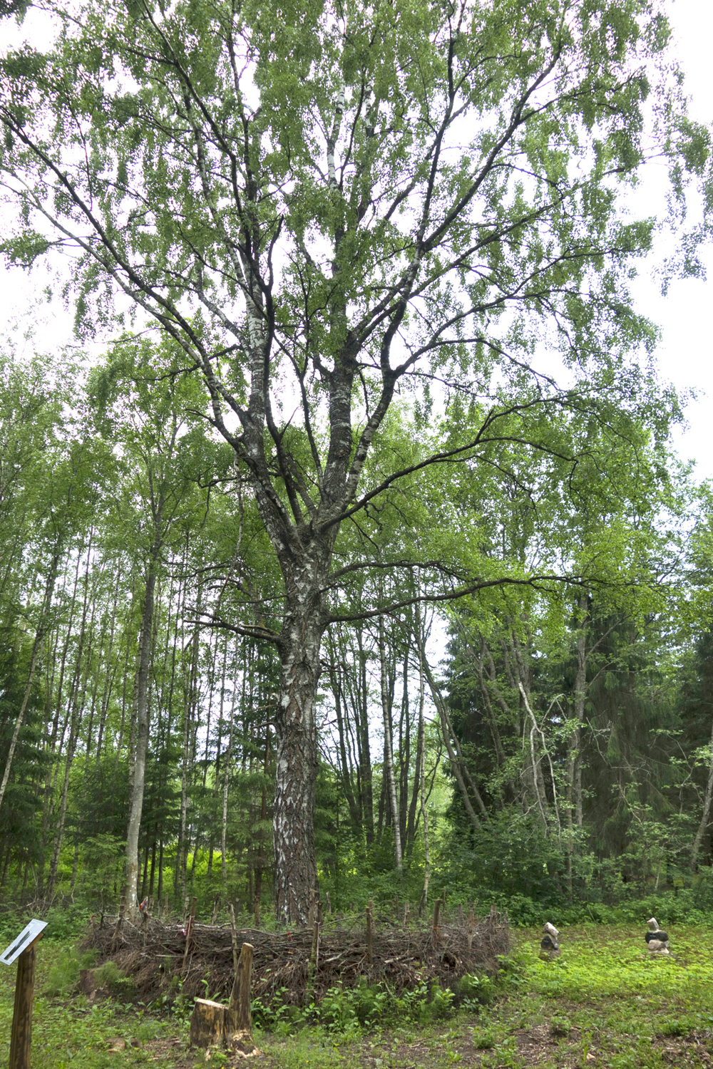
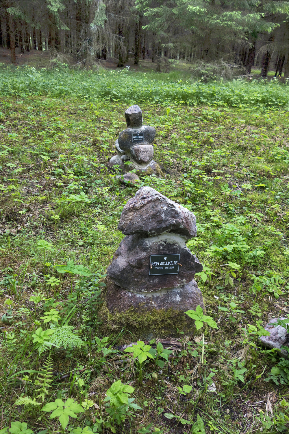
Leaving Kollassaare, we pass memorial stones by the Kollassaare Holy Birch or Hiiekõiv. Two good men are commemorated here: Rein Arjukese (1941–2018) established the Matsimäe–Simisalu nature trail and Simisalu Hikers’ Home, and made certain that the Kollassaare farmstead was properly maintained, Raivo Harak was a nature man from Tartu County and an expert in survival courses.
On the right side of the path we can see a well-preserved hole where flax stems used to be soaked to separate them from fibres.

The trail now runs along the old farm road through the fresh boreal forest, across the wooded meadow and the bog bridge and through transitional bog forest.
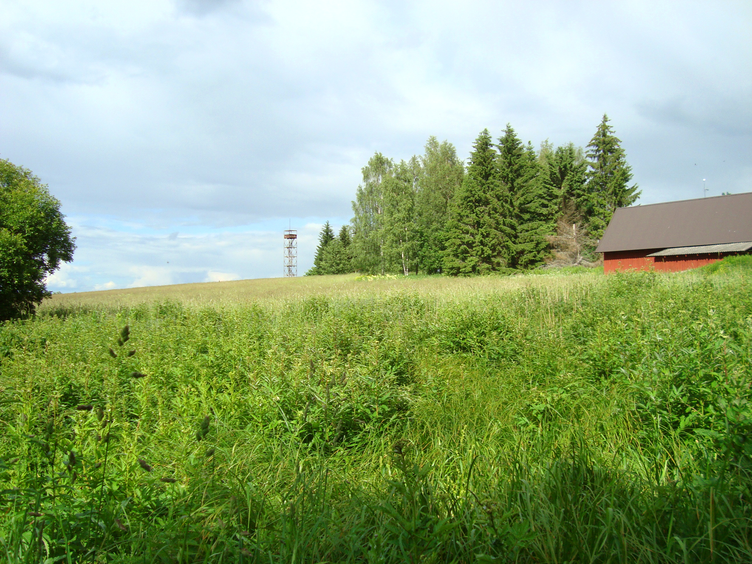
The path finally turns right, the skies expand and Simisalu’s roofs and the observation tower soon come into view.
It took us a bit under two hours to walk from Matsimäe to Simisalu (plus the time we spent at Kollassaare), covering around 7.5 km; together with the path from Matsimäe’s Lake Pühajärv to the quarry of Lake Vahessaare, about 8.5 km.
Daila Aas and Tiiu Allikvee. 2012, 2021.
Accommodation at Matsimäe Lake Pühajärv or Lake Vahessaare
Contact: RMK, phone +372 604 7212; Info.aegviidu@rmk.ee
Accommodation in Kollassaare
Contact: MTÜ Estlander, phone +372 5563 4030; info@estlander.org
Please arrange accommodation in good time!
Sources
https://loodusegakoos.ee/kuhuminna/puhkealad/aegviidu-korvemaa-puhkeala/1567
http://vana.loodusajakiri.ee/eesti_loodus/EL/vanaweb/0108/ann2.html
http://vana.loodusajakiri.ee/eesti_loodus/artikkel3203_3169.html